
The Amazonia-1 is the first Earth observation satellite totally developed in Brazil. Its mission is to detect and monitor deforestation in the Amazon.
Source: Space.com
A Brazilian Earth observation satellite soared to space aboard an Indian rocket late Saturday (Feb. 27) along with 18 passenger satellites from the United States and India.
The Indian Space Research Organisation (ISRO) launch, which carried Brazil’s Amazonia-1 satellite into orbit, lifted off at 11:54 p.m. EST Saturday (0454 GMT or 1024 local time Sunday) from the Satish Dhawan Space Centre in Sriharikota, India. An ISRO Polar Satellite Launch Vehicle (PSLV) carried Amazonia-1 and 18 smaller satellites into space using a “DL” variant that has two strap-on boosters, ISRO said in a description of the mission.
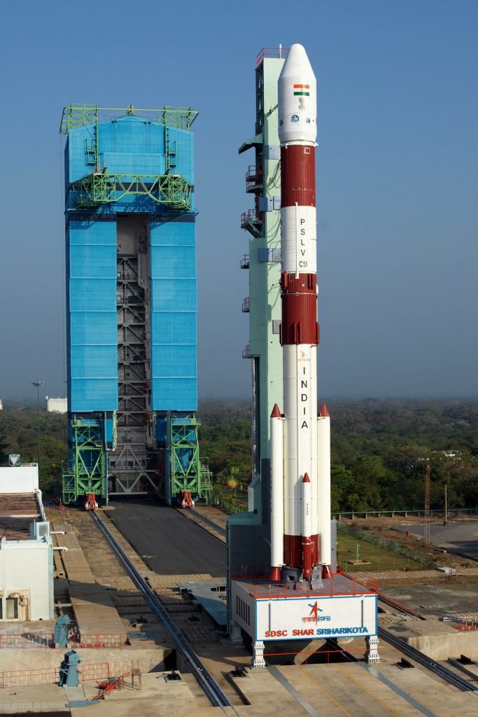
“The satellite is in very good health,” ISRO Chairman K. Sivan said after the launch. “The solar panels have deployed and it is functioning very nicely.”
The 18 other satellites include a mix of Indian and American craft. The Indian-built satellites include Satish Dhawan SAT (which studies radiation, space weather and communications), 3 UNITYsat (for radio relay) and a technology demonstrator satellite called SindhuNetra.
The American ones include another technology demonstrator called SAI-1 NanoConnect-2, and 12 “SpaceBees” from Swarm Technologies, part of a larger constellation the company is building in low Earth orbit.
The Amazonia-1 satellite and the mission
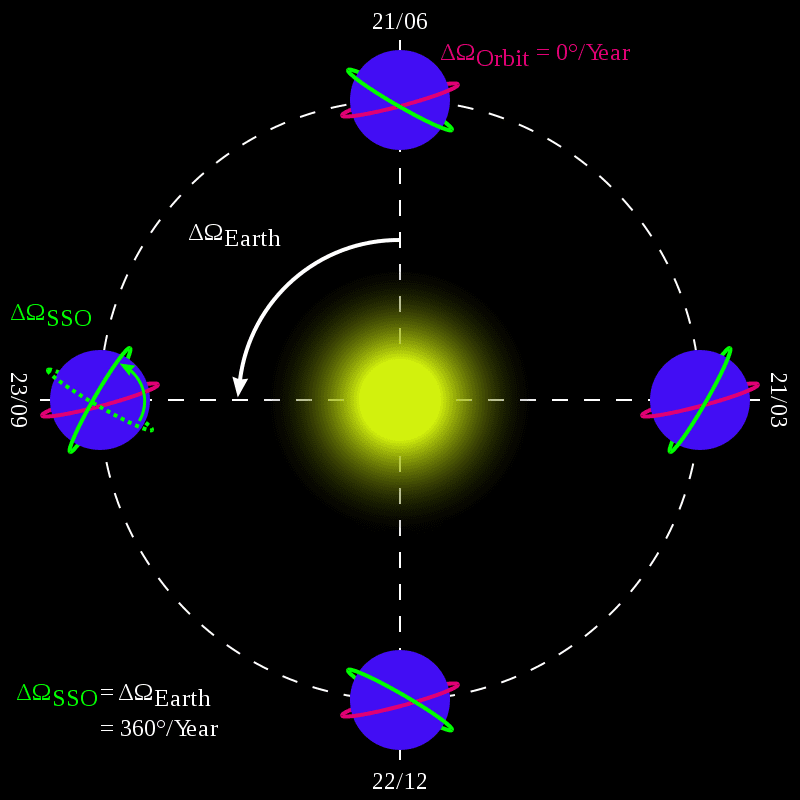
The satellite is in 752 km of altitude in a Sun-synchronous orbit, an orbit that passes close to the Earth’s poles, but satellite’s movement appears the same from the Sun’s perspective.
Amazonia-1 weighs 638 kg. Will produce planet’s images every 5 days, with a 3-band camera of visible spectrum (VIS) and another of near-infrared spectrum (NIR), allowing to show 850 km² with 60 meters resolution. Can track deforestation even with cloudy weather.
Source: INPE
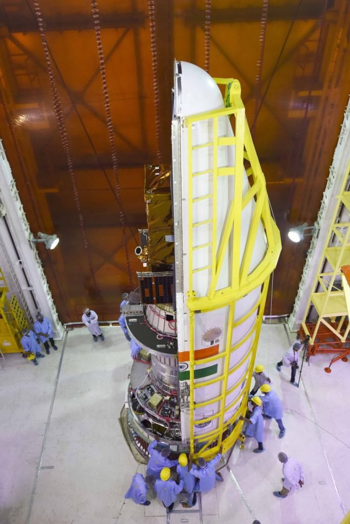
The Amazonia series satellites is composed by two independent modules: a Service Module, which is the Multi-Mission Platform (MMP), and a Payload Module, which houses image cameras and equipment for recording and transmitting image data.
The figure below illustrates the Amazonia 1 satellite with its two modules: Multi Mission Platform (Service Module, lower) and the Payload Module (upper part of the satellite). The closing panels are separated to illustrate the internal arrangement of the equipment and subsystems. The solar panel is shown in its stowed position (launch phase configuration).

Amazonia mission will launch two more satellites: Amazonia-1B e Amazonia-2.
Source: INPE
The Amazon Mission will provide remote sensing data (images) to observe and monitor deforestation, especially in the Amazon region, as well as the diversified agriculture throughout the country with a high revisit rate, working in synergy with existing environmental programs.
Its data will be useful to other related applications, such as: monitoring of the coastal region, water reservoirs, natural and cultivated forests, environmental disasters, among others.
The data will be available to both the scientific community and government agencies and to users interested in a better understanding of the terrestrial environment.


