Scientists started to use drones to fly very close to volcanoes, collect gases, and predict eruptions for early warning.
Source: Science Alert
With an estimated 300 active volcanoes on Earth, the challenge is how to monitor them all to send out early warnings before they erupt. Measuring volcanic gas emissions is also no easy task.
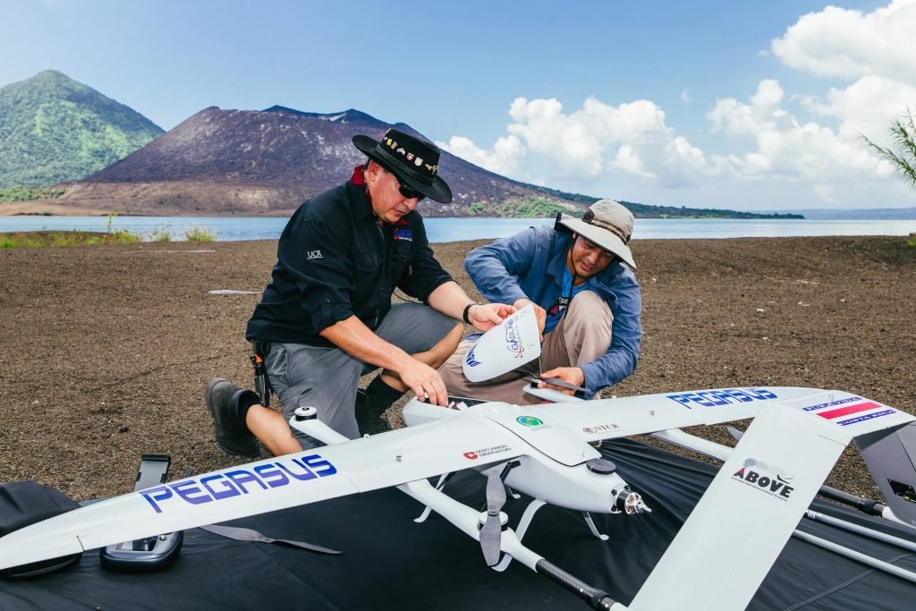
Now researchers have designed specially-adapted drones to help gather data from an active volcano in Papua New Guinea (PNG).
The drones could help local communities monitor nearby volcanoes and forecast future eruptions. Their measurements could also tell us more about the most inaccessible, highly active volcanoes on the planet and how volcanoes contribute to the global carbon cycle.
The Manam volcano is located on an island just 10 kilometres (6 miles) wide that sits off the northeast coast of PNG. The island is home to over 9,000 people and Manam Motu, as it’s known locally, is one of the most active volcanoes in the country. In 2004, a major eruption from Manam forced the entire island to evacuate to the mainland and devastated people’s crops and homes.

Scientists have a few ways of forecasting when a volcano is going to blow. They can monitor earthquake activity in the area to detect tremors which almost always precede eruptions, and look out for bulging in the volcano’s sloping walls as magma builds up underneath.
When clear skies allow, satellites can also rapidly detect and measure volcanic emissions of gases such as sulphur dioxide (SO2). Changes to these gas emissions can signal more activity in the volcano below.
Travelling to PNG, the international team set about testing two types of long-range drones equipped with gas sensors, cameras, and other devices during two field campaigns on Manam Island, in October 2018 and May 2019.
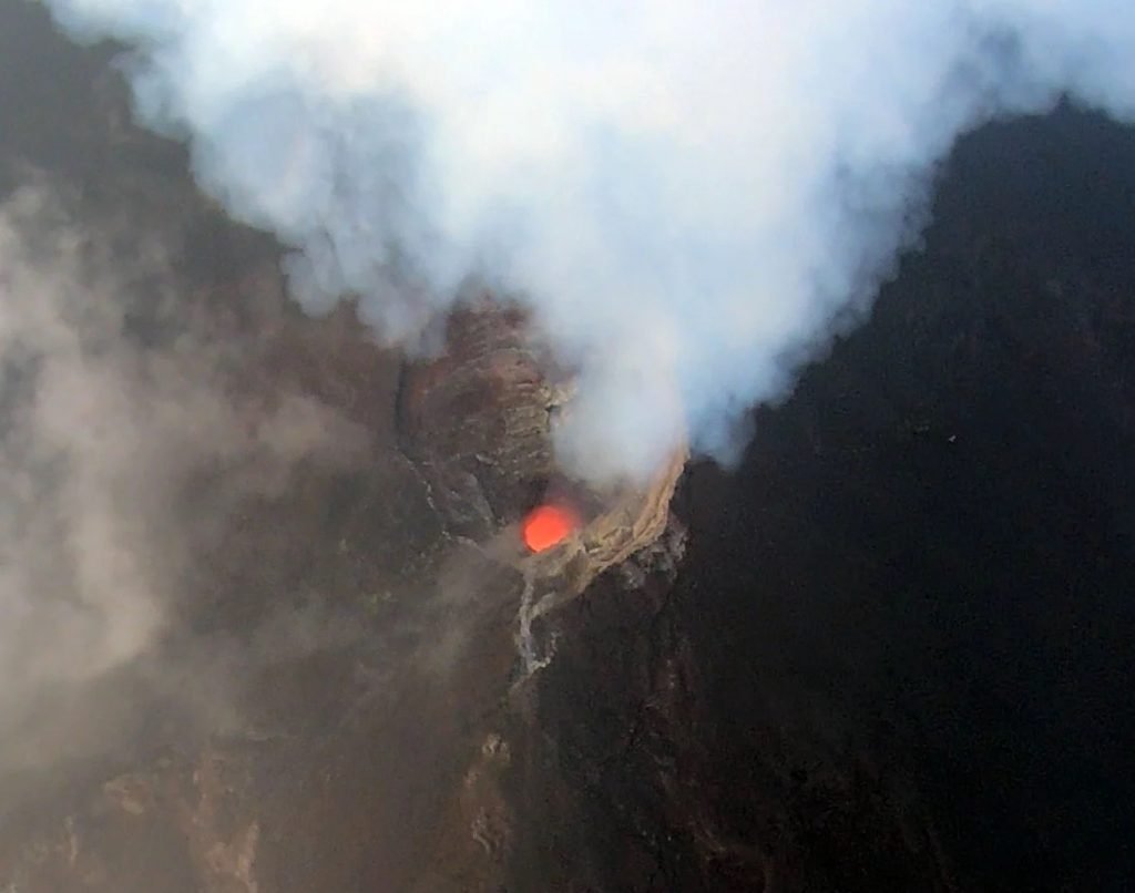
Manam’s steep slopes make it incredibly dangerous to even contemplate collecting gas samples on foot whereas the drones could safely fly right into the billowing plumes, helping the research team measure its volcanic gas emissions more accurately.
The drones flew over 2,000 metres (6,561 feet) high into Manam’s highly turbulent volcanic plumes and some 6 kilometres (3.7 miles) away from their launching pad, well out of sight of their pilots.
On each flight, the drones took images of Manam and its two craters, measured the gas composition right above the rising plumes and collected four bags full of extra gas for rapid analysis when the aircraft touched down.